Česky Earthquake of 3rd June 2008
Nejnovější zemětřeseníPředchozí zemětřeseníSlovníčekÚFZČEZSÚJBSeismologické odkazyFollowing earthquakePrevious earthquake
Date and time: 03.06.2008, 21:42:48 CEST
Magnitude: 2.7
Region: Austria, Mürzzuschlag
Coordinates: 47.670° N, 15.530° E
Distance from NPP Temelin: 190 km
Distance from NPP Dukovany:160 km
Additional info:
The earthquake was not felt by people in the Czech Republic and no damage to buildings or infrastructure is expected here.
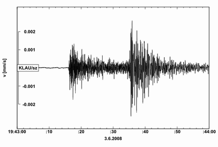
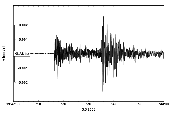
Seismogram
Seismogram of the earthquake from a station of the IPE local seismological network monitoring NPP Temelín. Time in the seismograms is in UTC (CEST - 2 hours). Vertical axis shows ground velocity in mm/s.