Česky Mine induced seismic event of 22nd November 2008
Nejnovější zemětřeseníPředchozí zemětřeseníSlovníčekÚFZČEZSÚJBSeismologické odkazyFollowing earthquakePrevious earthquake
Date and time: 22.11.2008, 23:27:00 CET
Type: mine induced seismic event
Magnitude: 3.7
Region: Czech Republic, Karviná region
Coordinates: 49.800° N, 18.500° E
Distance from NPP Temelin: 310 km
Distance from NPP Dukovany:190 km
100 km
Leaflet | Powered by Esri
Additional info:
The mine induced seismic event was felt by people in Karviná and Orlová with intensity III on the EMS-98 macroseismic scale. If you felt it too you can report your experience here.
It presented no threat to any of the Czech NPPs.
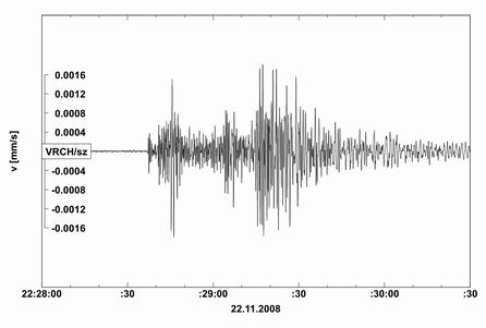
Seismogram
Seismogram of the seismic event from a station of the IPE local seismological network monitoring NPP Temelín. Time in the seismograms is in UTC (CET - 1 hour). Vertical axis shows ground velocity in mm/s.