Česky Earthquake of 26th August 2016
Nejnovější zemětřeseníPředchozí zemětřeseníSlovníčekÚFZČEZSÚJBSeismologické odkazyFollowing earthquakePrevious earthquake
Date and time: 26.08.2016, 09:43:34 CEST
Magnitude: 2.9
Region: Austria, Styria, Mürzzuschlag
Coordinates: 47.612° N, 15.673° E
Distance from NPP Temelin: 200 km
Distance from NPP Dukovany:170 km
Additional info:
The earthquake was not felt by people in the Czech Republic and no damage to buildings or infrastructure is expected here.
The strongest one of a series of dozens of earthquakes recorded from this area 26.8.-28.8.2016
More details can be found at ZAMG Austria or at the IPE Facebook.
Seismogram
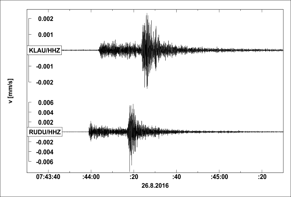
Seismogram of the earthquake from stations of the IPE local seismological networks monitoring the Czech NPPs. The upper track is from Temelín network and the lower one from Dukovany network. Time in the seismograms is in UTC (CEST - 2 hours). Vertical axis shows ground velocity in mm/s.